Monday, July 30: Princess Bay to Cadboro Bay, Vancouver Island

Today we head south for a destination we’ve been looking forward to:  Victoria!  We’ve been there by boat a couple of other times, but it’s out of the way of our usual cruising area and eats up at least 3 days so we don’t go often.

In the past, we’ve enjoyed a stopover in Cadboro Bay.  It’s the home of the University of Victoria, a nice bay, a quaint village in its own right that has a one-block business district and a great park right on the sandy beach, and only about 8 nautical miles from Victoria.  We like to anchor there overnight, then get an early start into the city in the morning.  We usually stay a night or two right downtown, then come back for another night at Cadboro before heading north again into the Gulf Islands.

Both Cadboro Bay and Victoria are on the very south eastern tip of Vancouver Island, and basically lie on the Strait of Juan de Fuca.  We travel SE down Haro Strait, with Vancouver Island off to our right until we “turn the corner” and reach Cadboro.  As we got closer, the wind really started picking up and the sea got choppy.  We’ve been in worse, but it was still uncomfortable.  Once we actually made the turn, it really picked up.  We couldn’t wait to get into the protection of the bay.  Unfortunately, to our dismay, the bay was almost as choppy as outside!  After we anchored, the wind was howling from the southwest and good sized rolling waves were bounding in, hitting us broadside and rocking us back and forth.  Hmmm.  It’s never been like this for us in here.  Not much we could do, though.

We checked the marine forecast and found out that there are strong wind warnings in this area for until Friday.   We were REALLY looking forward to going to Victoria, but we REALLY didn’t want to venture out into the Strait of Juan de Fuca during strong wind warnings.  We know the boat can handle it, just not sure about our stomachs.  You don’t want to mess with the Strait when it’s misbehaving.

We sat on the boat, at anchor, almost feeling seasick because of the waves.  What to do?  And then it dawned on us:  we’re only about 10 miles from Victoria BY LAND!  Instead of beating ourselves up tomorrow cruising there, followed by the same thing the next day cruising back, we could just dinghy into shore and grab the bus that stops a block away!

Oh we feel much better.  This is a good plan.  The only downside is that it is going to be a long, sleepless night if this wind doesn’t die down.

Sunday, July 29: Montague Harbour to Princess Bay, Portland Island

Well, Kristine and I got lost today.  Really lost.  Seriously.  No, not aboard the Elsa but on perfectly dry land. 

First things first.  It was a nice calm morning, and we went ashore to say goodbye to Montague Harbour.  At one part of the park, there is a stretch of low land that’s wider than an isthmus but narrow enough to walk across in a few minutes.  It is the home of a big marshy area, home to lots of wildlife.  Not the stinky kind of marsh, just very nice with a trail along one side.  We took a walk over to the beach on the other side and saw a little fog out there – pretty unusual for this area.

Back aboard, we set our course for Princess Bay, on Portland Island.  Another Provincial Park.  We came here last year for the first time and only stayed for lunch and a hike, this year we decided to spend the night. It’s a nice bay, gets a little crowded sometimes because the room to anchor is limited but we found a good spot.  Last year, we were with Kristine’s sister Barbara and took a hike counterclockwise around about half the island, then followed a trail that cut through the middle to get back to where we started.  This year, we figured we’d go the other direction.

It’s a great trail, with views:

And it drops down to a great campsite right on a shell beach that looks across to another similar beach:


This is where the getting lost part starts.  At this campsite, there is a map that shows the trail system. 


We had started at the ? on the bottom and hiked clockwise around to the red “you are here” star.  After taking some photos, we wanted to continue on that trail shown on the map.  We had a little trouble finding it – it didn’t seem to continue where the other one left off, and there were no signs pointing to where it might be.  We poked around a little and finally found it.  We thought.  It wasn’t quite as developed as the other one, but we rationalized that it just wasn’t as popular and how nice it would be to have the whole trail to ourselves.  We followed it for a while, and it got less and less easy to follow.  We had misgivings.  But we persevered.  Finally we reached a point where we decided it was just too hard to follow and turned to go back.  Trouble was, when we turned around we couldn’t even see where we had been walking.  It all looked like the same underbrush.  We went a few yards in one direction, then another, then another.  We picked what we thought was a trail and went several yards until it ran out.  After a half dozen false starts, we literally didn’t know where we were.  It sounds silly, but we got a little nervous.  It gave me a new appreciation for how people can get lost in the woods – you look around, and everything looks the same in every direction.

We weren’t totally lost, of course, we knew we needed to go downhill and eventually we’d hit the water.  But we had to start bushwacking through underbrush.  To shorten the story, we made our way back to that campsite (although not to the trail we left on!) and from there it was an easy hike out on the trail we came in on.  But jeeze!

That was enough excitement for one day.  Back to the boat for happy hour and a barbeque.


Saturday, July 28: Selby Cove to Montague Harbour, Galiano Island

Before I start on today’s entry, I realized that I forgot to point out something from a few days ago, when we stayed our first night in Canada.  It’s something we’ve only seen on the Pender Islands that exemplifies one of the big differences between the Gulf Islands and the San Juans.

While out for a walk, we came across this sign:
If you can’t read it, it’s for a “car stop,” sort of like a designated hitchhiking zone.  People wait there for a ride, and drivers can pick them up or not.  The rules are spelled out on the sign:  either person can turn the other down, the ride is free, etc.  There’s even a map of the islands showing where the other official car stops are.  We thought it was pretty cool.

Now on to today’s adventure:  nothing much happened.  The weather continues to cooperate and feels much warmer than the mid-60’s that were forecast.  We didn’t feel like going too far today, rather we wanted to go somewhere in an hour or two where we could just relax in the sun.  Montague Harbour, on Galiano Island, fit the bill.


Before we got underway, we dinghied ashore and explored a small peninsula that would be an island in a few hours when the tide came up.  The main part of Prevost Island is on the left and the future island is on the right; the shells I’m standing are what will become the seafloor. 


In one of the trees off to the left, a bald eagle was perched up high looking for breakfast:


We’ve been to Montague many times – I even went there once in Junior High as part of a YMCA Camp Orkila session.  It’s a big, protected bay, probably the biggest we’ve stayed at so far, and it’s all a provincial park including campsites on the shore. 


We mainly wanted to be lazy, as I said, but we did go ashore and hike some of the trails that make up the park.  We found an isolated shell beach and some clever artwork:


As boring as it sounds, we went back to the boat for the afternoon to finish a couple of books, work on our tans, and enjoy the scenery.


Friday, July 27: Ganges to Selby Cove, Prevost Island

A lazy day today.  We spent the morning running, well, walking some errands around Ganges.  Here are some photos of notable landmarks:


About 1:00 we cast off and headed out into a pretty stiff breeze.  The sun was still out, but it was definitely cooler than yesterday.  A newspaper we bought in town forecast sunny days ahead, but highs only in the mid to upper 60’s.  I have a definite feeling that we are getting cheated out of summer this year.

Once again we didn’t have a specific destination for today.  We decided to cruise down Long Harbor to see if that might be a good spot to stay.  Long Harbor is on the same island as Ganges (the biggest island in the Gulf Islands by far) and is a long, skinny inlet that roughly parallels Ganges Harbor and is very close.  On the chart, it looks like the fingers of a glove where the fingers are land and the spaces between are the harbors.  We’ve been by Long Harbor a million times, but never ventured in.

It is very pretty.  The BC Ferries stop about midway down; if you are coming by ferry to Ganges, this is where you would get off and then drive probably 15 – 20 minutes.  We passed the ferry terminal and went to the head of the bay, where there was a tiny private marina and several boats tied to permanent buoys.  It looked nice, but we chose not to stay there this time.  We turned around and made the very short hop across Captain Passage to one of our favorite spots, Selby Cove on Prevost Island.

We’ve never seen more than a couple other boats here, and today was no exception.  The cove is wooded all around with tall evergreens and a few Madronna trees, or Arbutus as the Canadians call them.  By the time we finally got situated it was about 3:30, we spend the rest of the day reading, barbequing, and watching the sunset:


Thursday, July 26: Medicine Beach to Ganges, Saltspring Island

We looked at the charts over coffee to decide where to go today.  We considered three places, one that we have been to many times and enjoy and two others that we’ve never been to but look interesting.  Eventually we decided to check out one of the new places and stay there if we liked it, if not go to a fourth place.
After a leisurely morning, we headed through the small canal I mentioned yesterday


to a small bay named Horton Bay, on Mayne Island.  It’s a small, very well protected bay and a photo we saw of it made it look very inviting.  The charts indicate it can be a tricky place to get to, as the narrow, shallow channels leading in are strewn with big rocks.  But in we went, and it wasn’t too tricky as long as we went slow and paid attention.  But once in, we decided not to spend the day there.  It was very pretty, but didn’t really offer much to occupy us and it was a little crowded with a number of boats already on private buoys.

So it was on to our fourth choice, Ganges, which is the largest “town” in the Gulf Islands.  It’s really more of a village.  It’s been a week since we’ve been able to do things we can only (easily) do from a dock – like laundry, grocery shopping, long hot showers, charge our computer and get online, and fill our water tanks.  The dock we like to go to is right in the center of things, but it’s usually crowded and first come first served.  Luckily, just as we approached and saw no room, a sailboat loosened his lines and took off which left just enough room for us.  You don’t really parallel park a boat like you do a car; you need to size up the space to judge if you can fit, then you nose in at an angle and swing the stern toward the dock.  If the wind is blowing the complexity increases.  I’m happy to say we got into this spot on the dock by the skin of our teeth:


The rest of the afternoon was spent doing our chores along with walking the streets to see what had changed since our last visit.  Not much.  In the evening, there are two restaurants at the head of our dock that feature live, outdoor music every night.  The Tree House Café had a solo woman blues singer who was quite good, we enjoyed the free concert.

Wednesday, July 25: Sucia Island to Medicine Beach, North Pender Island, Canada

We woke to a sunny morning today, the first time!  Finally!  And the forecast is for continuing nice weather.  Things are looking up.
A short report today.  We crossed over into Canada and are now in the Canadian Gulf Islands.  Geologically, these islands were formed at the same time as the San Juans, but they always appear different to us in both appearance and character.  They’re not nearly as populated as the San Juans, and the people who do live here are very nice, low key, rural living folks.  Over the last decades the San Juans’ population has grown considerably, and with that comes a completely different attitude – more like the suburbs of a big city.  We really like the Gulf Islands.

We cleared customs at the port of Bedwell Harbor, on South Pender Island.  A quick, routine stop.  About one half hour later, we were putting down the anchor at Medicine Beach, North Pender Island.  These two islands used to be one, connected by a thin strip of land, but in 1903 they cut a canal through the strip so boats could pass and built a bridge over the canal so cars could too.  We stayed at Medicine Beach for the first time last year and liked it.  It’s uncrowded and peaceful.  Here’s what it looks like from shore, we were the lone power boat among three sailboats::


We took a walk up the hill and found that the small grocery store had gone out of business due to family problems, too bad.  The adjacent liquor store was still open, however, and some cold beer sounded pretty good on what was turning into a hot day.

That’s about it.  We lounged around in the sun the rest of the afternoon, commenting several times on how good it felt!

Tuesday, July 24: Jones Island to Sucia Island (the long way)

Sometimes I notice something, and it makes an impression for some reason, but I think no more about it.  I notice it again, and tuck the thought away.  After the third or fourth time, I realize it is somewhat unusual, which is why it’s making an impression, but finally there comes an observation that makes me think “I better do something about that.”  That series of observations occurred over the last few days, but it wasn’t until 2:00 AM today that it finally hit me.

When the bilge fills up with water to a certain level a pump automatically turns on to pump it overboard, accompanied by a red light illuminating on the dashboard.  The pump is very quiet, you don’t really hear it.  The sound of water being pumped into the drink is also very quiet unless you’re at just the right spot outside.  Nevertheless, I had noticed that the pump was working more frequently than normal over the last few days.  But all I did was notice it.  This morning, however, when I briefly came to consciousness at 2:00 AM, I noticed that the red light was on and that’s when I finally made the connection.  The bilge was filling with water WAY too frequently.  Of course, then I was wide awake, trying to figure out why this had been happening and what to do about it.

I don’t usually do my best thinking when I’m sleepy, but in this case I actually deduced the problem and formulated a plan.  When I got up in the morning, I remembered my plan but my first inclination was to rationalize the problem away as not being a big deal.  After a few cups of coffee, though, I decided it was a big deal and we should get it repaired while we were still in the US and near several repair facilities.

Without going into detail, a seal was leaking near where the axle for the propeller goes through the hull.  This seal normally gets replaced every 5-6 years, but as I checked my records I found that I hadn’t replaced it since 1995.  I called the closest marina to us to see if they could fit us in and, sure enough, they could.  We cruised about an hour to West Sound Marina, ate some lunch while the mechanic fixed it, and we were on our way.  This definitely counts as one of those things I worry about happening before we leave on a boat trip, but in the scheme of things it was about as minor as they come.  We didn’t have to be towed anywhere, a good thing.  And fixing it was definitely better than burning out the bilge pump from overuse and letting the boat sink.

The sun came out about noon, right on schedule according to the latest forecast, and we set off for Sucia Island.  There are several bays there, we picked one we’d hiked to before but never stayed at:  Echo Bay.  Sucia is about the northernmost island in the San Juans and is another marine park accessible only by boat.


 We found a perfect anchorage and went ashore for a four mile hike out to another bay, Ewing Cove, and back. 


At the end of the trail, we were greeted by this bald eagle.


Back at the boat we lit the barbeque, watched the sunrise, and patted ourselves for dealing with our leaking boat so successfully.  And we looked forward to more sunshine ahead!


Monday, July 23: Spencer Spit, Lopez Island, to Jones Island


Happy Birthday Kristine!  Although we celebrated yesterday, it's still a happy day!

I’m about to tell an embarrassing story.  Fortunately, as I get older I expect to embarrass myself more than when I was younger and it doesn’t bother me so much to do so.  However, it’s still embarrassing.  Don’t tell anyone.

We had a good night’s sleep, but were awakened early by a sizeable wind blowing.  It wasn’t too uncomfortable since we were at anchor and thus naturally pointed into the wind, so instead of rocking side to side (not fun) we were gently pitching to and fro (not bad).  We got up and figured we could put up with the wind, because at least it wasn’t raining.  After breakfast and reading for a few hours, we decided to go ashore for a walk before heading off to our next destination.  Kristine wisely thought to suggest we bring our rain pants because the wind was still strong enough that we were likely to get some water over the sides of the dinghy as we made our way through the waves to shore.

The wind was blowing toward shore, so actually the ride wasn’t too bad.  We bounced up and down, got a little wet, sang “over the bounding main,” and made it to shore relatively unscathed.  After a nice walk through Spencer Spit state park, it was time to return to the Elsa and get on our way.

Now for the embarrassing part.  Because the wind was blowing toward us, and the waves were rolling toward us, getting off the shore proved to be much more difficult than we expected.  We smugly thought we were prepared when we took off our shoes and socks and put our rainpants on over our jeans.  We got the dinghy into the water and used an oar to push us out deep enough to put the outboard down, but in that short amount of time the waves turned us sideways, rushed over the sidewall, and pushed us right back on to shore.  This clearly wasn’t going to work.  We must have looked like the two stooges.  What to do?

I could only come up with one idea:  I needed to stay in the water, pushing the boat back far enough that I could put down the outboard, steady it while Kristine pulled the cord to start it, and then jump back in the boat.  One problem was that I only have one pair of long pants on this trip (it’s summer, remember) and I really didn’t want to get them soaked.  I knew I’d be at least up to my waist in water.  So, off with the pants.  Don’t worry, I discretely took them off and put my rain pants back on, so it wasn’t quite as bad as you might imagine.  I rolled up my shoes and pants and gave them to Kristine to tuck under her jacket.  She sat in the boat and I started pushing.  Water in the San Juans is COLD.  Kristine pulled the cord, and the outboard started on the first try!  Yay!  But then, because our tiny outboard has no “neutral,” only “forward,” the dinghy bravely started plying the waves and heading out to deeper water.  Waves were coming over its bow and I was quickly realizing that I needed to jump aboard pronto.  With a deep breath and a big leap, I heaved myself over the transom and into the boat.  Kristine was laughing hysterically.  All the rest of my clothes were wet (it got deeper faster than I planned), but at least my pants stayed dry.  We took more water over the bow as we headed back out to the Elsa, but eventually made it safely, pulled the anchor, and headed off.

Thankfully there are no photos to show you of this event.

We had a couple of destinations picked out for today, depending on how crowded the first one was, but when we pulled into the north cove of Jones Island we saw there was plenty of room so we settled in.  This is another small island park that’s a real gem.  We’d bring the kids here when they were little and it was known for the tame deer that would eat out of your hand.  Now, of course, that is not PC but there are still deer roaming around – you just have to look a little harder for them.  They’ve reverted to being afraid of people. 

We put down the anchor, ran a stern line ashore to prevent us from swinging around (it’s a small bay), and the sun actually came out!  This is a day earlier than forecast, but we are ready.  Here's the Elsa at rest.  Note the wet clothes hanging from the rails up above, drying in the sun:

Sunday, July 22: Eagle Harbor, Cypress Island to Decatur Head, Decatur Island


What is this with summer this year?  While the news reporters keep talking about how so much of the country is experiencing its worst drought in decades, the Great Pacific Northwest gets one day of sunshine and it’s back to rain.  Actually, the forecast is for two days of rain, but then nice weather beginning Tuesday.  We can hardly wait.

Not much to do this morning.  We planned to leave around 11:30 to take Allison and Michael back to Anacortes.  Last night we put the crab trap down because of all the eelgrass in the bay – crabs love eelgrass.  Sure enough, this morning we had four keepers, so we went about cleaning and cooking them so we could give A and M each a couple to take home.  When the rain let up a bit, we went ashore to explore one of the many trails on this island, but it was pretty mucky from all the rain and we didn’t get far.  Sure pretty though.  Here’s a view from the trail:


Back at the boat, I checked out a few things on the engine as I do every day and found I needed to add some oil.  Darned if I didn’t drop the oil cap into the bilge.  Man, it was hard to keep my expletives to myself.  Fortunately, I thought, I bought a big magnet for just such an occasion – tie some string to it, lower it into the space beside the engine and into the depths of the bilge, piece of cake.  Except when I tested the magnet on the other oil cap, I quickly discovered that it wasn’t magnetic.  Who would make such an important piece of the engine out of plastic?

Plan B:  change into work clothes, nestle into the tiny space between the engine and the bottom of the boat, have someone hand me the long barbeque tongs, and start grasping.  Voila!  Got it on the first try.

With the oil cap retrieved, cleaned, and replaced, we were on our way.  We loved having Allison and Michael with us on the boat like the old days, but said goodbye and got ready to leave ourselves.  Around the office, a couple with two grade school girls appeared with a terrible story – they had just had a boat fire and were rescued by the Coast Guard!  Apparently, their boat was just in the shop for three weeks getting some injector work done, and this was their first day out on vacation.  They had just left when they heard a BANG and then the engine caught on fire!  They put it out with the fire extinguisher, but the engine wouldn’t shut off and so it kept flaring up again.  It made my oil-cap-in-the-bilge experience seem very trivial.  The poor family was all pretty shell-shocked, the girls were scared, jeeze it was awful.

We considered ourselves lucky (so far, knock wood) and headed out.  By now it was raining again so we didn’t want to go too far.  We headed across Rosario Strait toward James Island, which is another state park and right on the outskirts of the San Juans.  The buoys were taken and we didn’t want to anchor there (the currents are pretty strong), so we went another five minutes and put the anchor down behind Decatur Head, on the northeast side of Decatur Island.  It’s pretty here, except for the rain, and although we wouldn’t probably return it will do for tonight.  One more day of rain and then the weather forecaster had better be right.

PS  After writing the last paragraph, we decided we had to leave.  A number of people live on Decatur Island, but there are no stores there and it is not served by the state ferry system.  Instead, a couple of water taxis take people back and forth to the other islands and towns.  One taxi in particular came and went three or four times in the hour and a half we were there, and as he sped in and out past us he had no regard for the wake he was leaving behind.  Our boat went rocking, stuff flew off counters, and he was oblivious.  Since we didn’t know how late he would be operating or how early in the morning he would begin again, we decided that this wasn’t the place for us.  We pulled anchor and cruised about 30 minutes to Spencer Spit, on Lopez Island.  It was still rainy and crappy, but at least the mighty Elsa stayed relatively steady.  A bit after we arrived, we were treated to a beautiful display of nature:


Saturday, July 21: Saddlebag Island to Eagle Harbor, Cypress Island


We’ve been looking forward to today.  We had prearranged with Allison and Michael that they would drive to Anacortes and we would pick them up for an overnight cruise to celebrate Kristine’s birthday, which technically occurs next week.  We pulled the crab trap and were horrified to find too few keepers for dinner, so we rebaited it and dropped it back in the drink, figuring we’d circle back around once Allison and Michael were aboard and try again.

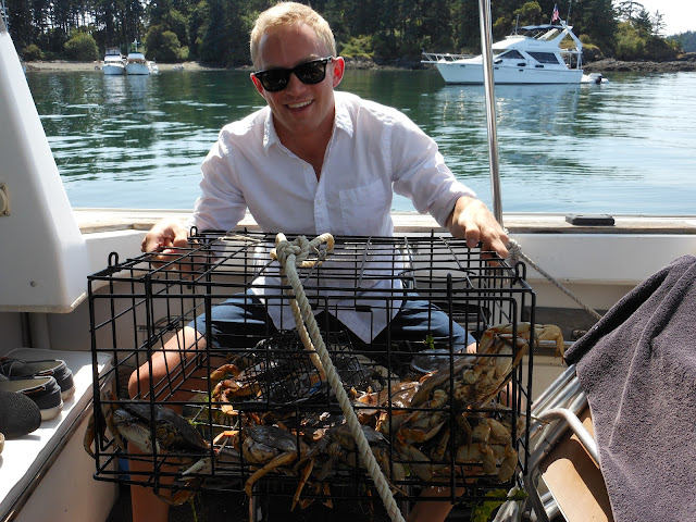
Anacortes is only about 30 minutes away, so we went into the marina to tie up and run some errands.  They showed up at lunchtime and we ate, then cast off.  First stop, Saddlebag.  Much better luck; THAT’S what I’m talking about:


Thanks for pulling them up, Michael!


Today’s destination is a place we’ve never stopped at, but cruised by last year and it looked like a beautiful place.  Cypress Island isn’t considered part of the San Juans by most people because it’s on the east side of the Rosario Strait, but it’s a pretty big island that’s entirely forested.  We went into Eagle Harbor, on the northeast side, and found a perfect place to anchor.  The seabed is pretty thick with eelgrass and played tricks with our depth finder as we were looking for a place to stop:  it kept reading about 8 feet, too shallow, and yet there were other boats anchored very successfully nearby.  We finally stopped and lowered a line over the edge and discovered that it was actually a little over 20 feet deep, just perfect.  Down went the hook.


The sun was out, so we spent the rest of the day cooking our crab, catching up with the family news, and enjoying a birthday feast and celebration.  Happy birthday Kristine!


Friday, July 20: Hope Island to Saddlebag Island

When did “red sky at night, sailor’s delight” stop working?  After that beautiful sunset last night, we woke to thunder, lightening, and rain this morning.  Trying to be optimistic, we patted ourselves on our backs for deciding to begin our trip yesterday instead of today.


We hadn't planned to go far today, so we decided to just wait out the rain.  The forecast was for drier skies by afternoon, and right at noon the rain stopped and the sky brightened.  Still overcast, but we decided it was good enough to get going.  We pulled anchor and headed for the Swinomish Channel, a narrow dredged channel that runs through the town of La Conner.  Normally picturesque and fun to transit, today was a different story.  By the time we entered the channel on the south side, the tide was so low that the depth under the boat was measuring between 2 and 4 feet.  That’s too close for comfort, but there was a similar sized boat just in front of us and he seemed to be moving forward, so we took a chance and followed him.  After maybe 100 yards, we got back to 6 feet, but then a very strong current started pushing against us.  Bad timing – a minus tide AND strong opposing current.  No real harm done, we just kept poking along and the trip took about an hour longer than we had figured.

Three hours later, we dropped anchor in the north bay of Saddlebag Island.  This is a tiny island that is also a state park, but mostly it is known as a crabbing “hot spot.”  It’s usually not hard to catch your limit of big, tasty, Dungeness crab here.  Seemed like a good way to kick off the trip.  The brightening sky from earlier turned into VERY low clouds:


But we dropped a crab trap and took the dinghy to shore to stretch our legs.  There were some campers there, also dismayed by the change in weather, but otherwise enjoying the island.  After a 90 minute exploration of the island we returned to the crab trap and had dinner for the night!  We reset it and planned to check our luck in the morning.


Thursday, July 19: Seattle to Hope Island


The days before a boat trip are not relaxing for me.  Nor are the first couple of days of cruising.  This old boat has definitely had its share of problems over the years, and for some reason they always come up when we are using her, never when she’s safely tucked into her slip on Lake Union.  Because of that, I toss and turn for a few nights wondering what this trip will bring.  After the first few days I begin to relax and enjoy myself.  (Until, of course, some new problem surfaces.)

We’re heading north again, into the Canadian Gulf Islands, to revisit some favorite places and try some new ones.  The first day is always the longest, as it takes us a full day to get from Seattle to the edge of the San Juan Islands.  After that, we usually cruise only a few hours each day.  Allison helped with our transport from home to boat last night, so that we could sleep on the boat and be ready for an early departure today.  Since neither of us slept much, mainly due to my worrying, it was pretty easy to get up and underway by about 7:30.

The good news was that the sun was out!  We had a quick trip through the locks and were in the salt water heading north before 9:00.  The boater behind us in the locks mentioned that it was his first time through and was looking for pointers, which I gladly gave him.  It’s a little harrowing your first few times; I still remember mine.  Helping him know what to expect reminded Kristine and me of how many skills we’ve developed since we bought this boat in 1994.

The cruise north is long, as I said, and pretty boring, but on a sunny day it’s not too bad.  The salt air smells good, and the sights look familiar.  We pass some small towns and residential areas.  Here’s a guy who has a nice beach to himself.  Anyone for waterfront property?


Our destination today is Hope Island.  Usually, we use this as a jumping off point to go through Deception Pass and head across Rosario Strait to the San Juans, but this time we’re going to take a different route.  We anchor near the shore of this undeveloped small island and congratulate ourselves and the Elsa on having a good day – no problems yet! 


After dinner, we took the dinghy out and did a relaxing circumnavigation of the island, took about 45 minutes.  Back aboard the Elsa, we enjoyed the sunset and I looked forward to catching up on some sleep.